
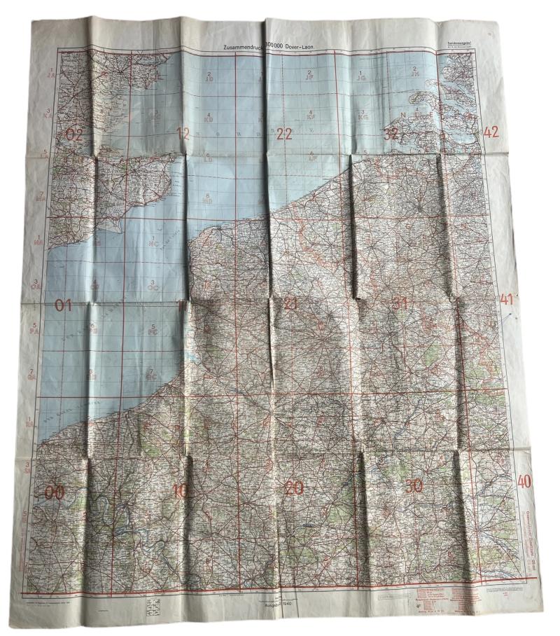
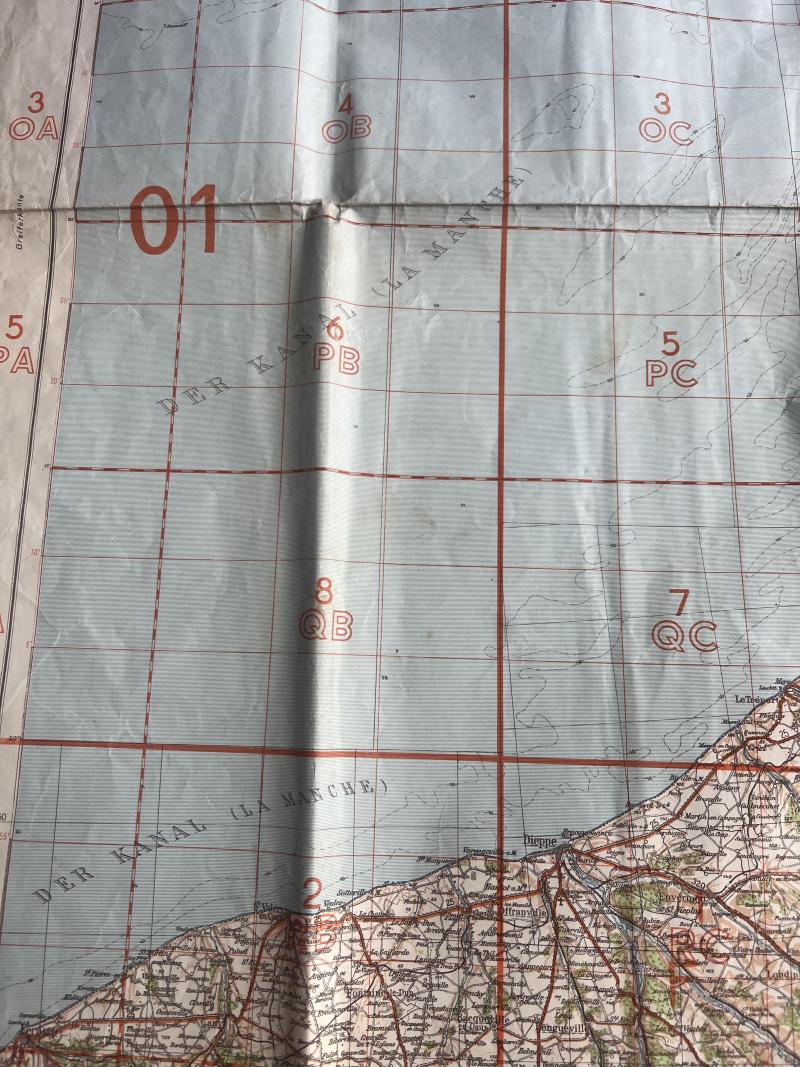
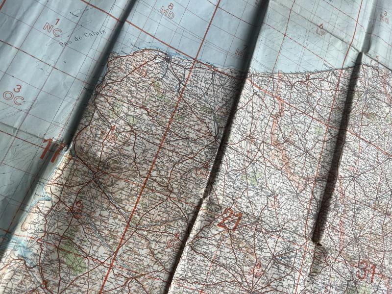
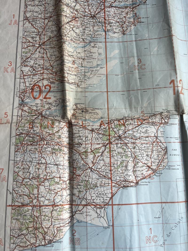
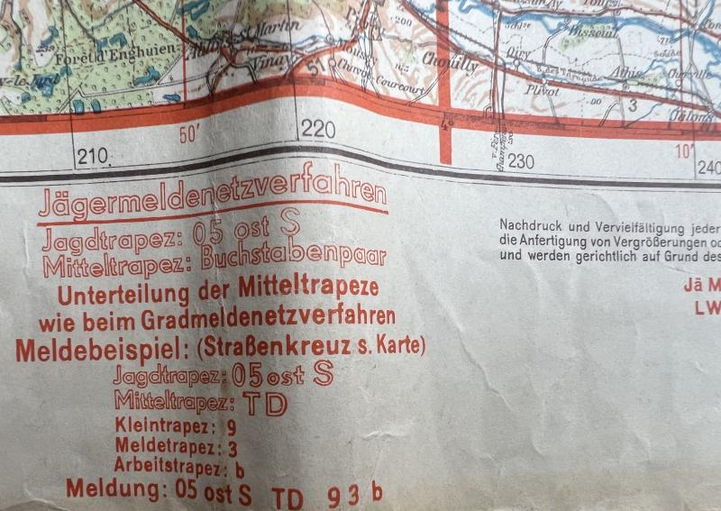
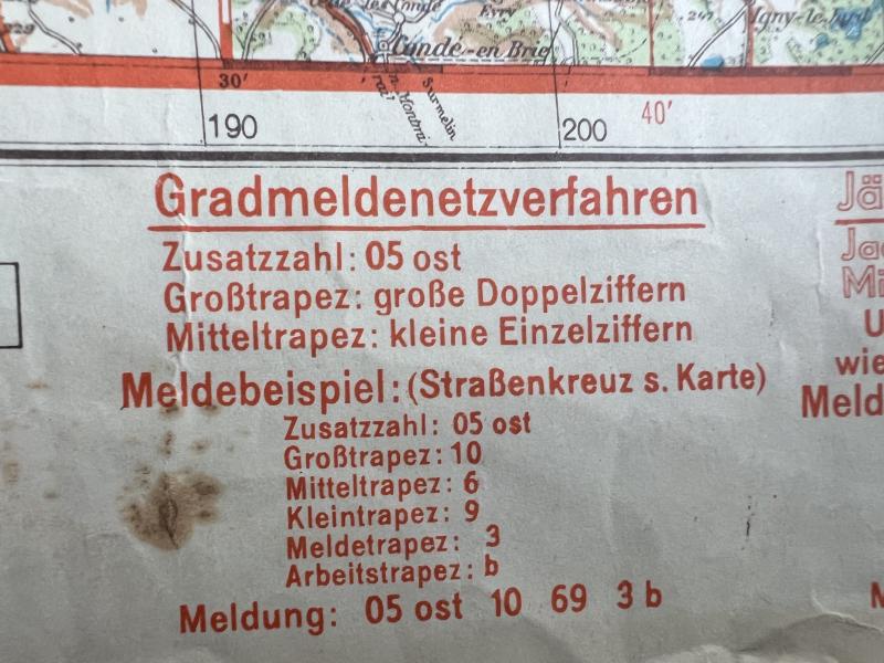
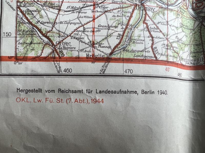
German 1940 Dated Map Dover 133X 103 MM - Norther France - Flandres And Zeeland - Nice Used Condition
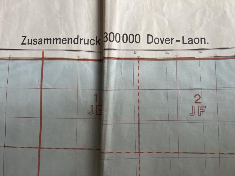
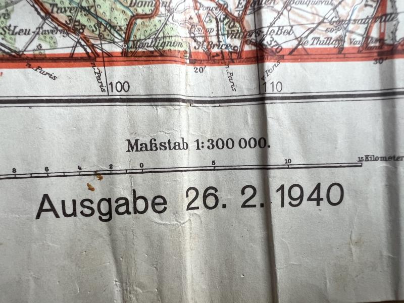
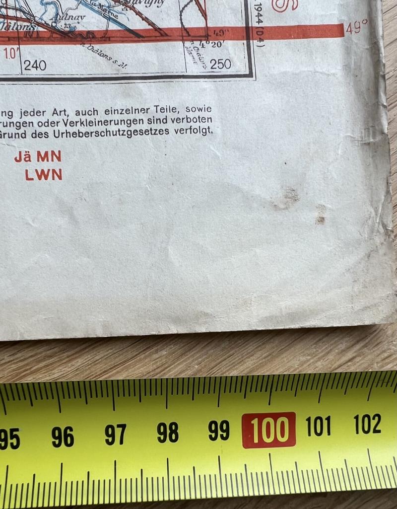
Very interesting large German staff map of Dover-Loan region. Covering Dover and parts of the (south) east coast, Calais, Boulogne and parts of Northern France. The flandres in Belgium and The Dutch islands of Zeeland. Dated 1940/44 and clearly marked "nur fur dem dienstgebrauch" being a military issued map. Hard to upgrade!
Code: 57296
150.00 EUR